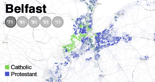
Living Apart Together: mapping the human geography of Northern Ireland
The UK’s recent decision to leave the European Union and the recent snap assembly election has coincided with a renewed focus on demographic shifts in Northern Ireland. I’ve had the pleasure of working on a mapping project with the detail and The Irish Times, looking at how - despite the progress that’s been made in the peace process - the two communities in Northern Ireland still live apart.
Paul Nolan’s article covered in both the Irish Times and in full on the detail as part of this project is a really great read.
The full interactive maps can be found here.